+91 63642 99888 contact@universallandsurveyors.com 1st Block, Rajajinagar, Bengaluru
Land Survey
Reliable land surveying services for every project need
Land surveying is essential for property development, ensuring accurate boundaries, preventing disputes, and confirming ownership. It provides crucial topographical data for design and regulatory compliance. At Universal Land Surveyors, we deliver reliable, high-quality surveying services, forming the foundation for successful projects. Trust our expertise and technology to guide your project from the ground up.
Precision land surveying services for construction and real estate projects
Boundary Survey
Our boundary surveys accurately define property lines, easements, and rights-of-way, ensuring clear delineation of land ownership and minimizing disputes between neighboring landowners.
Topographic Survey
We provide detailed topographical surveys that map the natural and man-made features of an area, offering crucial data for planning and design purposes.
Contour Survey
Our contour surveys accurately depict the elevation and slope of the land, essential for construction, drainage planning, and environmental assessment.
Revenue Surveys
We conduct revenue surveys to establish land ownership boundaries, ensuring precise and legal documentation for property transactions.
Construction Layout Marking
Our experts provide precise construction layout marking, translating architectural designs into physical ground markings for accurate construction execution.
Vasthu Survey
We offer Vasthu surveys that align your property’s layout with traditional Indian architectural principles, promoting harmony and prosperity in your living or working space.
As-Built Surveys
We deliver asbuilt surveys to document the exact location and dimensions of completed structures, ensuring they match the original plans and specifications.
DGPS Mapping
Utilizing Differential GPS (DGPS) technology, we offer highly accurate positioning data for a wide range of surveying applications, from land mapping to infrastructure development.
Drone/Aerial Survey
Our drone/aerial surveys capture high-resolution images and data from above, providing a comprehensive overview of large areas quickly and efficiently.
Coffee Estate Survey
Our specialized coffee estate surveys help in mapping and planning coffee plantations, optimizing land use and ensuring sustainable development.
Canal Survey
We conduct precise canal surveys to assist in the design, construction, and maintenance of waterways, crucial for irrigation and water management projects.
Lake Survey
Our lake surveys provide detailed information about water bodies, including depth, boundaries, and surrounding topography, aiding in conservation and development efforts.
Property Survey
We offer comprehensive property surveys that establish legal boundaries, support land development, and resolve property disputes with accuracy and clarity.
Boundary Survey
Our boundary surveys accurately define property lines, easements, and rights-of-way, ensuring clear delineation of land ownership and minimizing disputes between neighboring landowners.
Topographic Survey
We conduct topographic surveys to map the natural and man-made features of a property, including contours, elevations, vegetation, buildings, utilities, and drainage patterns. This information is essential for site planning, design, and engineering projects.
Revenue Surveys & Documentation
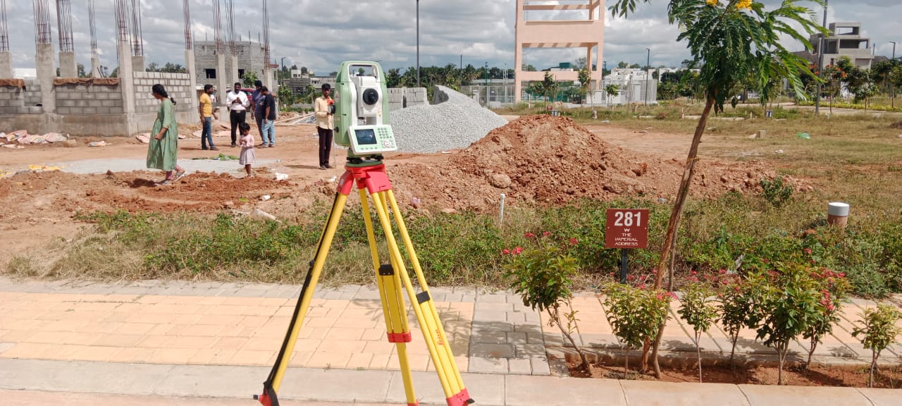
Revenue surveys involve the use of total station instruments, which combine electronic distance measurement (EDM) technology with angular measurements to determine precise horizontal and vertical positions of survey points. Surveyors use total stations to measure distances and record angles to accurately define parcel boundaries and corners.
Construction Layout and Staking
We provide precise construction layout and staking services to ensure accurate placement of buildings, roads, utilities, and other infrastructure elements according to design plans and specifications.
Vastu Surveys
We conduct thorough evaluations of building sites according to Vastu principles, considering factors such as land shape, orientation, surroundings, and natural elements.
As-Built Surveys
Our as-built surveys verify the location, dimensions, and elevations of constructed improvements, ensuring compliance with approved plans and facilitating project closeout and certification.
GIS / DGPS Mapping
Our Geographic Information Systems (GIS) expertise enables us to create customized maps, spatial databases, and geospatial analysis tools for land management, resource planning, and decision support.
Drone Aerial Mapping and Photogrammetry
Our drone aerial mapping and photogrammetry services utilize advanced imaging technology to capture high-resolution aerial images and create detailed maps, 3D models, and digital elevation models (DEMs). These accurate and up-to-date datasets are invaluable for site planning, land development, environmental assessments, and infrastructure projects.
Boundary
Surveys
Lorem ipsum dolor sit amet, consectetur adipiscing elit. Ut elit tellus, luctus nec ullamcorper mattis, pulvinar dapibus leo.
Topographic Surveys
Lorem ipsum dolor sit amet, consectetur adipiscing elit. Ut elit tellus, luctus nec ullamcorper mattis, pulvinar dapibus leo.
Vastu Surveys
Lorem ipsum dolor sit amet, consectetur adipiscing elit. Ut elit tellus, luctus nec ullamcorper mattis, pulvinar dapibus leo.
As-Built Surveys
Lorem ipsum dolor sit amet, consectetur adipiscing elit. Ut elit tellus, luctus nec ullamcorper mattis, pulvinar dapibus leo.
Ensuring high precision and compliance

Advanced Technology
We use the latest surveying equipment and software to ensure high precision and efficiency in all our surveys.

Experienced Team
Our team consists of highly skilled and certified professionals with extensive experience in land surveying.

Comprehensive Services
From boundary surveys to construction staking, we offer a wide range of services to meet every client’s unique needs.

Customer-Centric Approach
We prioritize our clients’ needs and work closely with them to deliver customized solutions that exceed their expectations.

Timely Delivery
We understand the importance of deadlines and are committed to delivering accurate survey results on time.
Some of our projects
Land surveying with cutting-edge equipment and expertise
Initial Consultation
We begin with a thorough consultation to understand your specific requirements and project goals.
Site Analysis
Our team conducts a detailed site analysis using advanced equipment to gather all necessary data.
Data Processing
Collected data is processed and analyzed using cutting-edge software to ensure precision and accuracy.
Report Preparation
We prepare a comprehensive survey report, including all findings and recommendations, tailored to your project's needs.
Client Review
The final report is presented to the client for review and any necessary adjustments are made.
Delivery
We deliver the final, detailed survey report, ensuring all your project requirements are met.
Explore other services

Soil Testing

Equipment Rentals

Equipment Sales & Service
Connect with our experts today
Universal Land Surveyors and Soil Testing Lab
Universal Land Surveyor and Soil Testing Lab is a leading provider of professional land surveying and soil testing services, serving clients across India


